Bandai Azuma skyline
The Bandai–Azuma Skyline (磐梯吾妻スカイライン) is a 28.7 km mountain road in Fukushima Prefecture that traverses the Azuma mountain range within Bandai-Asahi National Park. For cyclists, it is regarded as one of Japan’s classic high-altitude road climbs.
From the Takayu Onsen (North/East) side, the ascent is sustained and demanding, gaining roughly 900 m in elevation to a high point around 1,600 m at Jododaira. Average gradients generally sit in the mid-single digits, but extended sections exceed 7–8%, making it a steady endurance climb rather than a series of short ramps. The Tsuchiyu Pass (east) side is slightly longer and more gradual overall, though still a significant mountain effort.
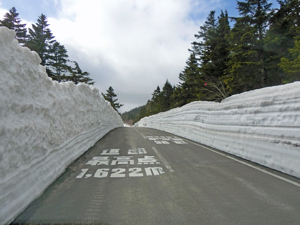
The road surface is generally well maintained, with consistent pavement quality and wide lanes by Japanese mountain road standards (as it was tolled until 2013). Traffic is mostly recreational—cars and motorcycles—especially during peak autumn foliage season and shortly after the spring reopening. Because of heavy snowfall, the Skyline is usually closed from mid-November to early April; early season rides may feature dramatic “snow corridors” along the roadside.
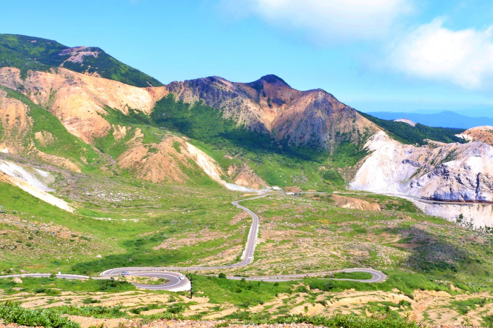
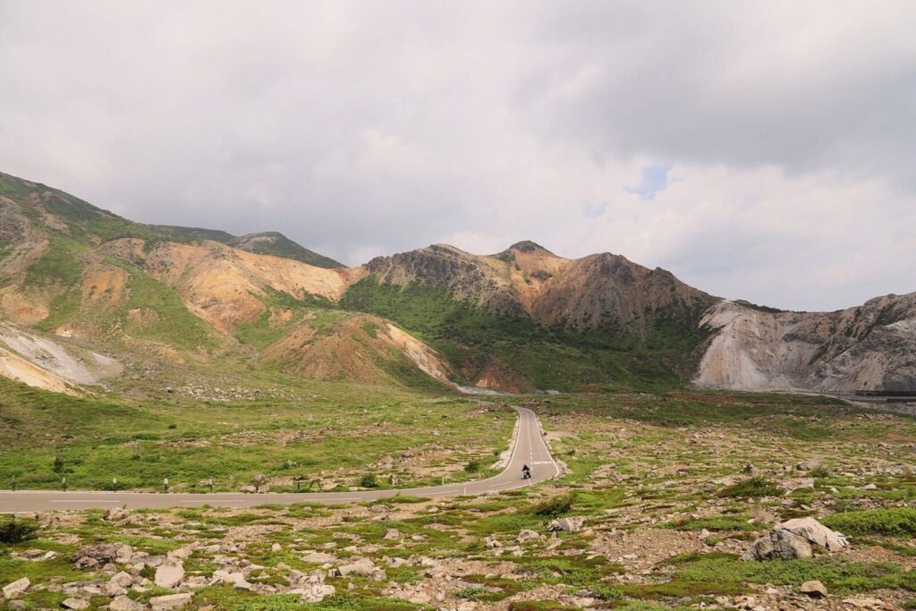
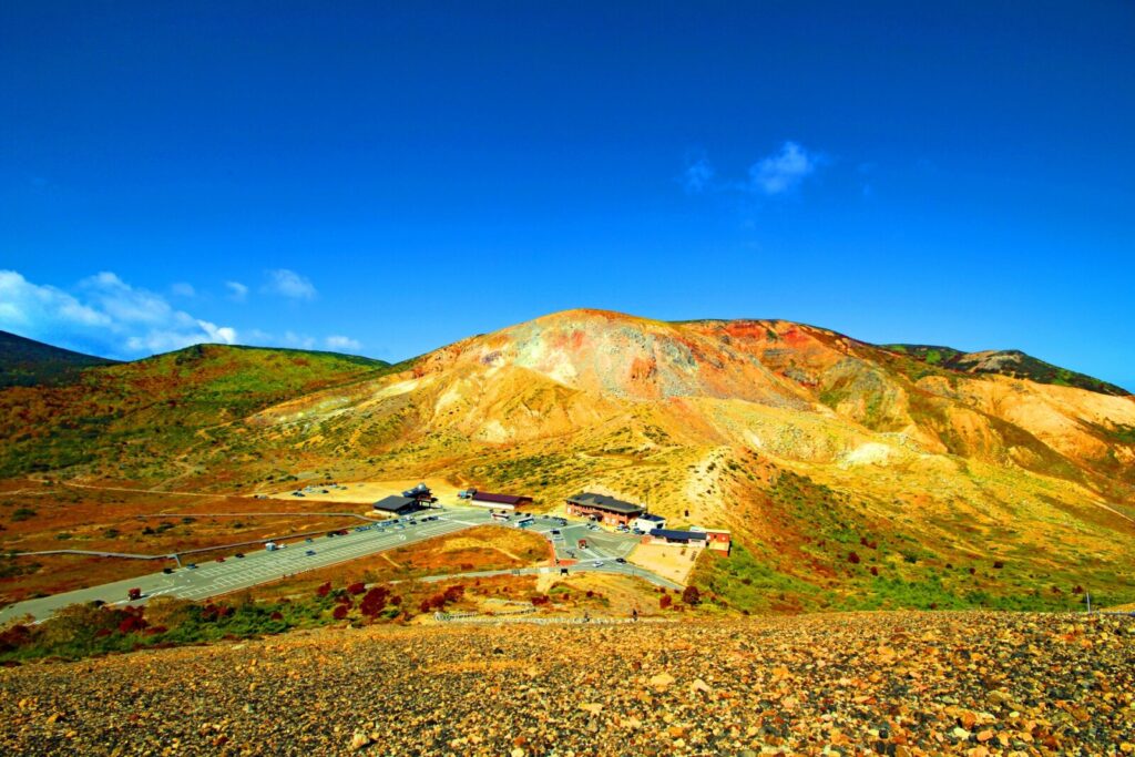
What distinguishes this climb is its alpine and volcanic terrain. Above the tree line near Jododaira, riders encounter open, windswept landscapes, sulfur vents, and views of Mount Azuma-Kofuji’s crater, giving the route a distinctly high-mountain character uncommon in much of Japan. Weather can change rapidly at elevation, with strong crosswinds and significantly cooler temperatures than at the base.
For experienced road cyclists, the Bandai–Azuma Skyline offers a sustained, scenic HC-style climb with expansive views and a rewarding summit plateau—arguably one of the premier road cycling ascents in the Tōhoku region.
The Route
The Route is a climb up the side of Mt. Bandai and then down the other side. It offers beautiful views over the tree line of Mt. Bandai
Spring
The Azuma Bandai Skyline is closed over the winter however when it opens in the spring it often has snow walls on the side which can be an interesting experience for cyclist. Look for a few days in a row that have been warm without precipitation to ensure the safest conditions
Fall Colours
The Azuma Bandai Skyline is particularly popular in the fall with the fall colours in October. This can also lead to signfiicant traffic as well. Traffic is typically lower on weekdays so if visiting during peak season.
Getting there and away
North End (Fukushima)
The North and lower end of the Azuma Bandai Skyline is the easiest to get to with a road (Fukushima Pref Route 70) leading directly from Fukushima Station directly into the Skyline. Fukushima Station is easy to access from Tokyo with many Tohoku Shinkansen services stopping there.
South End
The south end is in the mountains at National Route 115 (note that the tunnel heading East back towards Fukushima is closed to bicycles so one has to use the Route 30 to skip the tunnel or head either towardsInawashiro Lake (and Aizu Wakamatsu). The smaller Prefecturial Route 24 also offers a route towards Kooriyama. Kooriyama is also a stop on the Tokhoku Shinkansen as well.


